Latest Interactives
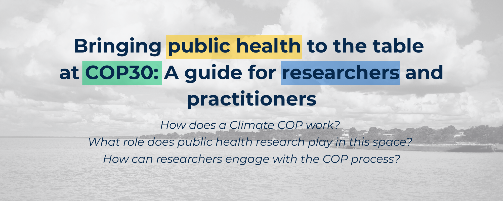
The SALURBAL-Climate team has developed this explainer to help public health students, researchers, and practitioners navigate the UN Climate COP, which will take place this | November in Brazil | , and to explore the role of health in climate decision-making.
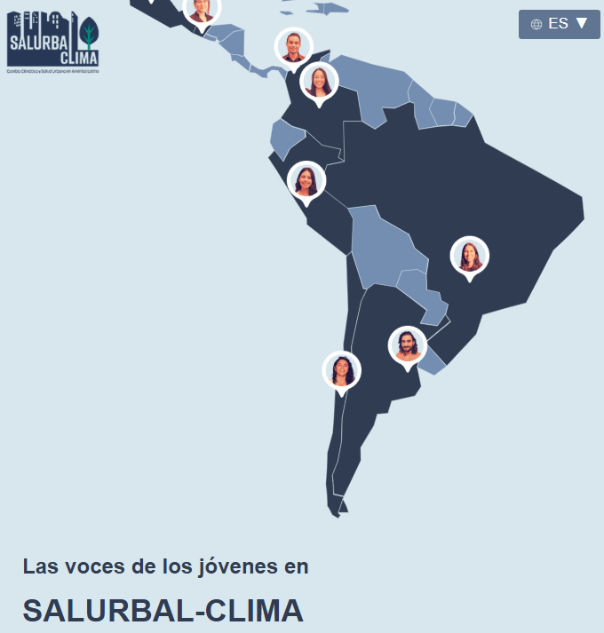
Embark on this tour of eight Latin American countries and learn more about this project through the experiences of its young researchers, who, with a multidisciplinary approach, analyze the connection between urban public health and climate change to promote community policies and actions. These are the stories that make SALURBAL-Climate possible.

In SALURBAL project, we evaluate urban transformations in precarious housing and informal settlements in Chile, Colombia, and Brazil. The goal is to highlight the role of these transformations in reducing vulnerability and increasing resilience to the impacts of climate change. The evaluation of local urban policies and transformations —such as RUCAS, TransMiCable, and Vila Viva— provides evidence to support decision-making in cities. Starting in November 2023, the SALURBAL-Climate project will aim to deepen our understanding of the connections between climate change, health, and inequity in Latin American cities, in order to guide urban policies and community actions.

The Drexel Urban Health Collaborative's interactive scrolly visually explains the SALURBAL project's rigorous protocol for defining cities, sub-cities, and neighborhoods. This scrolly guides users through the process of identifying urban agglomerations with 100,000+ residents, combining neighboring cities, and establishing geographic boundaries. The hierarchical structure includes levels for cities (L1), sub-cities (L2), and neighborhoods (L3), allowing for detailed health and wellbeing comparisons within and between 371 cities in 11 countries.
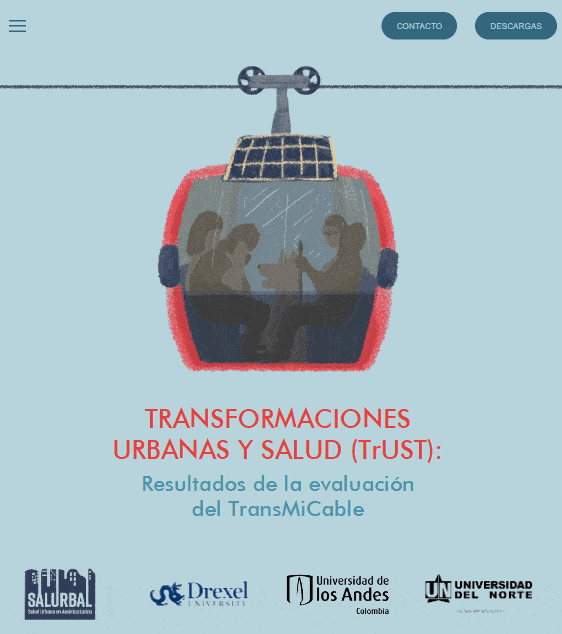
The scrollytelling of the study 'Urban Transformations and Health: The case of TransMiCable (TrUST)' offers a captivating journey into the story of the impacts of the cable car TransMiCable on the transport, air quality, physical activity, safety, and quality of life in a low-income settlement in Bogotá, Colombia. This interactive tool not only shares critical academic insights but also amplifies the voices of the local community, fostering its engagement. Designed to appeal to a wide audience interested in urban health, the user-friendly tool provides esencial data for informed decision-making in public policy.

ArcGIS map that displays SALURBAL L1AD and L2s
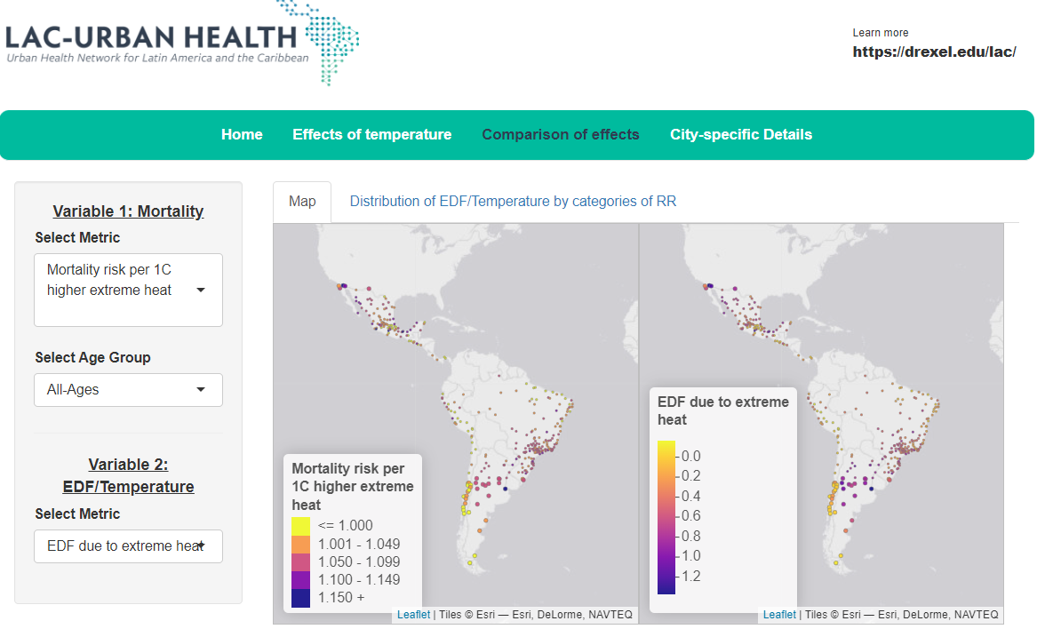
The study analyzes the impact of extreme ambient temperatures on mortality in 326 Latin American cities from 2002 to 2015, finding that a significant proportion of deaths are attributable to nonoptimal temperatures. The risks, particularly from heat-related deaths, are higher among older adults and for cardiovascular and respiratory deaths, highlighting the urgent need for climate change mitigation and adaptation strategies.
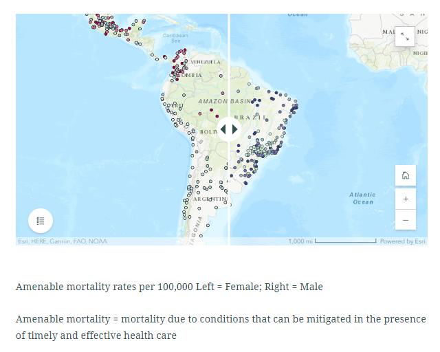
Number of deaths that could have been prevented through medical and health care differs dramatically across 363 cities in 9 countries

The study identifies and evaluates city profiles based on built landscape and street design characteristics in Latin American cities, using measures such as fragmentation, isolation, shape, street connectivity, length, and directness. The findings reveal that different built environment profiles have varying associations with social determinants of health and air pollution, emphasizing the need to consider these configurations in planning healthy and sustainable cities in the region.
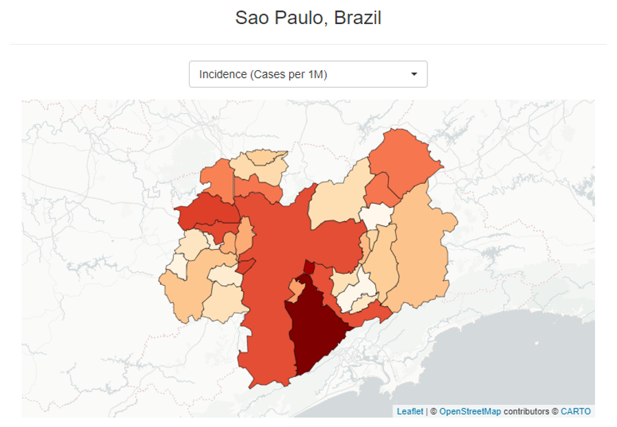
SALURBAL researchers are tracking the COVID-19 pandemic in Latin American countries, cities, and neighborhoods. The online dashboard developed by the SALURBAL project allows visitors to plot trends of COVID-19 cases and deaths as well as to map these outcomes at various geographic levels: country, city, and sub-city in Latin American countries and compare the progress of the pandemic across countries.
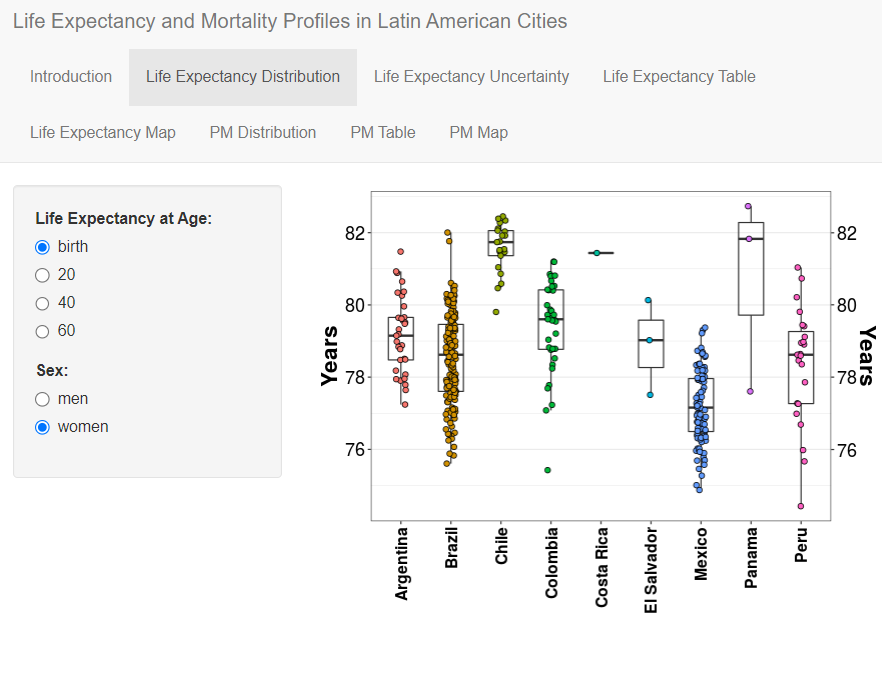
The SALURBAL project's harmonized dataset reveals significant variations in life expectancy and cause-specific mortality across 363 cities in nine Latin American countries, challenging the notion of a uniform urban health advantage. The study identifies modifiable factors such as education, water access, sanitation, and overcrowding, which are associated with life expectancy and causes of death, suggesting the potential for urban policies to improve health outcomes in Latin America and other urban environments.
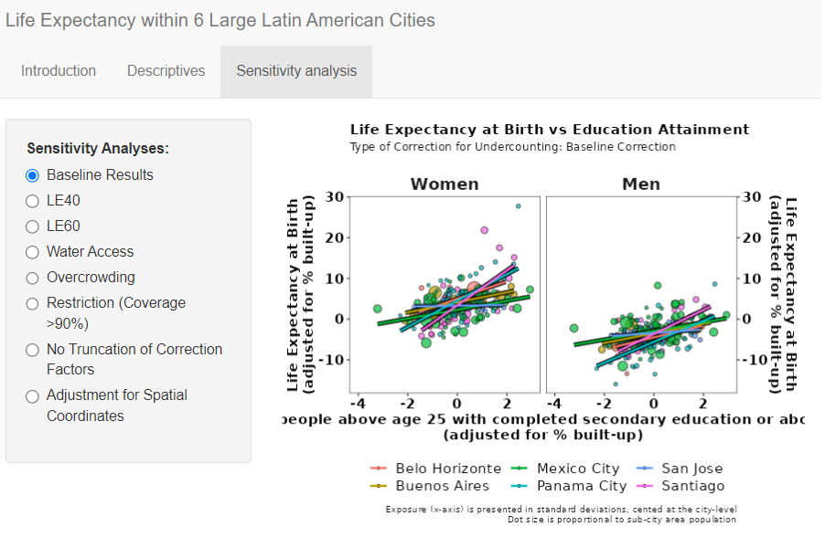
The study investigates life expectancy inequalities in six Latin American cities and their link to socioeconomic status. It reveals significant disparities in life expectancy within these cities, with higher socioeconomic status associated with longer life expectancy, emphasizing the need for policies addressing social inequalities to improve urban health.
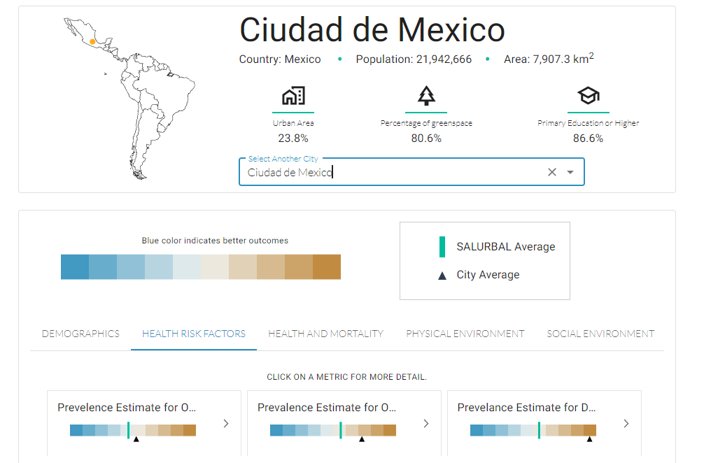
City Profiles are a set of interactive data visualizations that provide a snapshot of the city’s demographics, economy, housing, and transportation.